


advertisements


News

Weather
Posted: Mar 07, 2024 11:36 AMUpdated: Mar 08, 2024 9:23 AM
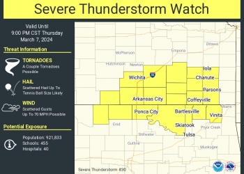
Severe Thunderstorm Watch Issued until 9 p.m.

Nathan Thompson
Additional thunderstorm development is expected late Thursday afternoon into tonight, specifically along the Oklahoma-Kansas border.
The Storm Prediction Center in Norman issued a Severe Thunderstorm Watch until 9 p.m. Thursday that includes Osage, Washington and Nowata counties in Oklahoma, and Chautauqua and Montgomery counties in Kansas.
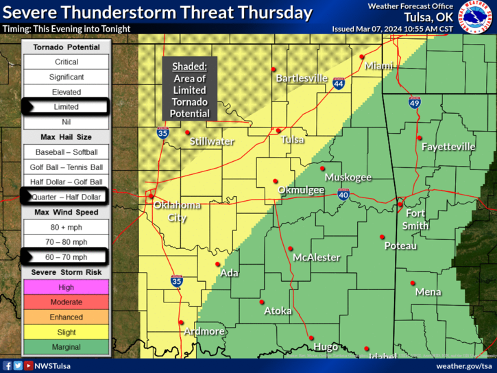
Large hail and locally damaging winds are the primary threats, though a limited tornado potential will exist in Osage, Washington and Nowata counties and for southeast Kansas.
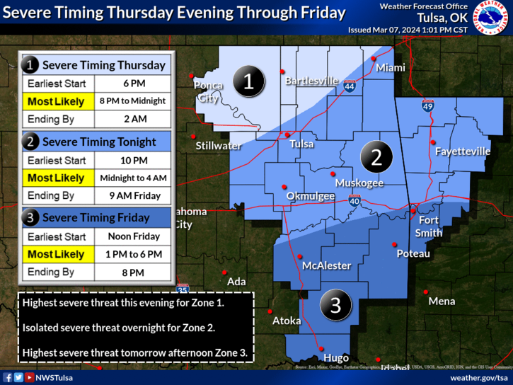
According to the National Weather Service, the risk for severe weather has increased from a marginal risk to a slight risk — that's a level 2 risk out of 5, with 5 being a high threat. If severe weather develops in the area, the earliest start would be 6 p.m. Thursday. The most likely timeframe is from 8 p.m. to midnight.
If severe weather threatens the area, KWON-KYFM-KRIG-KPGM will provide severe weather coverage as needed.
« Back to News