


News

Weather
Posted: Apr 25, 2024 10:48 AMUpdated: Apr 26, 2024 1:15 PM
Several Rounds of Storms Impact Area Through Sunday

An active weather pattern will bring several chances of storms during the next few days across northeast Oklahoma and southeast Kansas.
Here’s News On 6 Meteorologist Stephen Nehrenz.
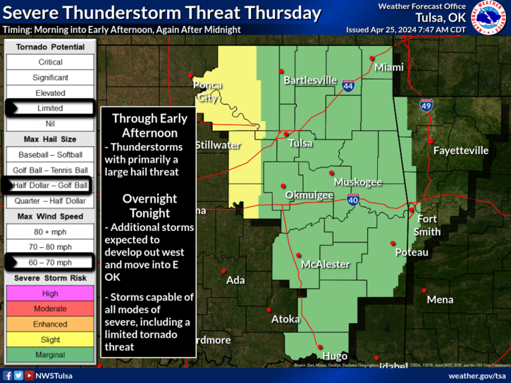
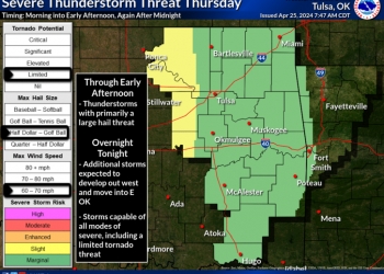
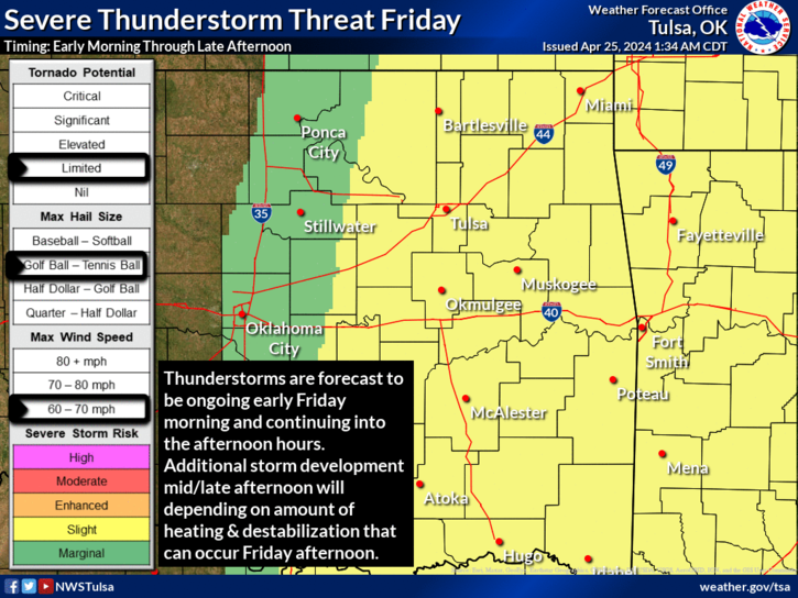
Severe storm threat continues Friday as thunderstorms are forecast to be ongoing across parts of the area early Friday morning. This activity is expected to continue into the afternoon hours as it spreads through the region. Additional thunderstorm development Friday mid- to late-afternoon remains dependent on the amount heating and destabilization that can occur Friday afternoon. All modes of severe weather, including a limited tornado threat will be possible Friday.
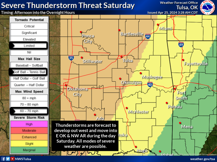
The severe storm threat increases Saturday. Storms are forecast to develop out west and move into the region during the afternoon hours and continue into Saturday night. Our listening area is under an enhanced risk — level 3 out of 5 — for Saturday. All modes of severe weather, including a limited tornado threat are possible Saturday afternoon into Saturday night.
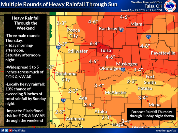
Three main rounds look to provide the greater amounts of rainfall with widespread 3 to 5 inches are forecast. Locally higher amounts are possible with a 10 percent chance of locally exceeding 8 inches by Sunday night. Multiple rounds of storms moving over the same locations will help to create a flash flood threat through the weekend. Continue to monitor latest forecasts as details are refined.
« Back to News