


News

Weather
Posted: Apr 22, 2026 12:34 PMUpdated: Apr 24, 2026 4:13 AM
AFTERNOON UPDATE: Severe Weather Risk Increases Thursday Night and for the Weekend

Thunderstorm chances develop late Thursday afternoon, and increase Thursday evening into Friday morning across northeast Oklahoma and southeast Kansas.
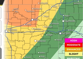
The listening area has been upgraded to a Level 3 of 5 severe weather risk zone. Large hail and damaging winds are the main severe threats. The tornado threat is a Level 2 of 4, or elevated.
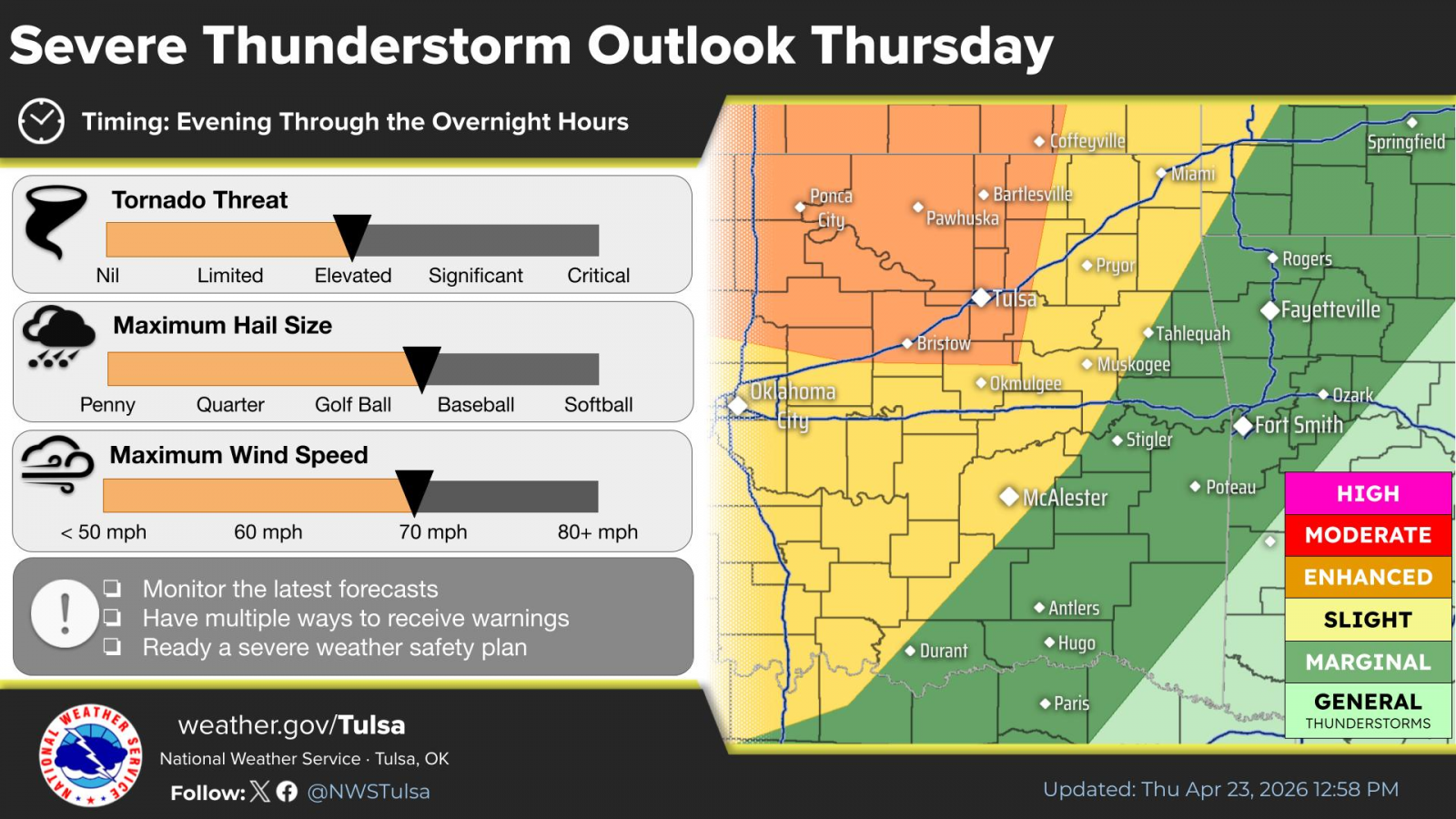
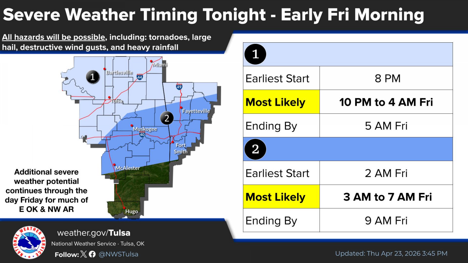
The most likely time for severe weather is between 10 p.m. Thursday and 4 a.m. Friday, although storms could fire up earlier. Storms should move out of the area by mid-morning Friday.
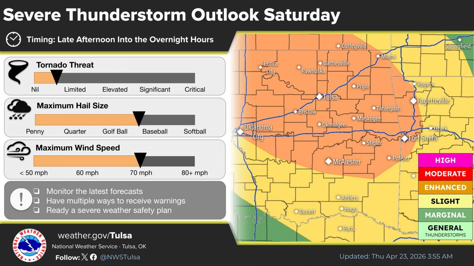
A frontal boundary is forecast to lift back northward Saturday afternoon and night, which will aid in increasing thunderstorm chances for northeast Oklahoma and southeast Kansas. A Level 3 of 5 risk exists for Saturday. Large hail and damaging winds are the primary severe threats.
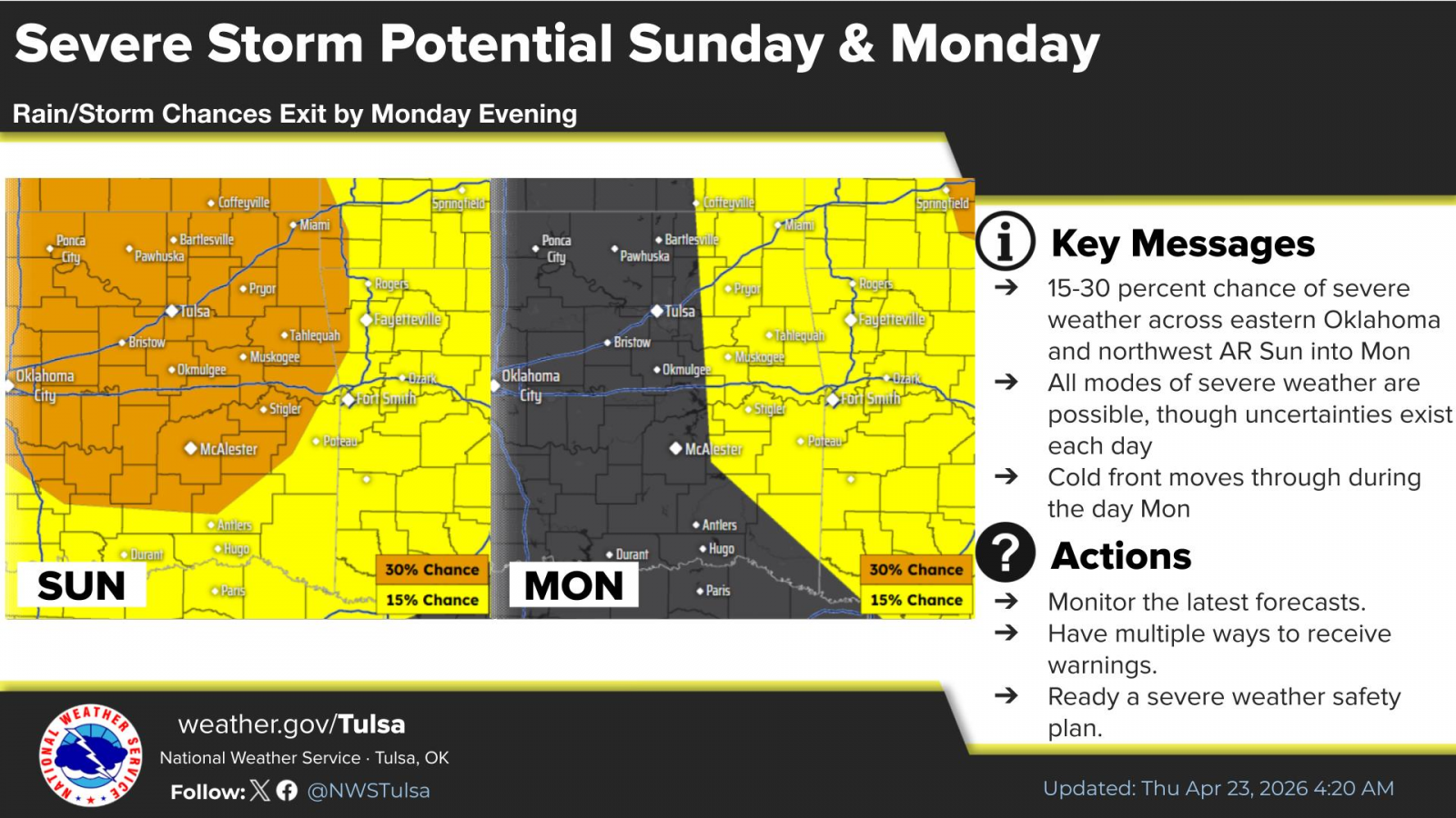
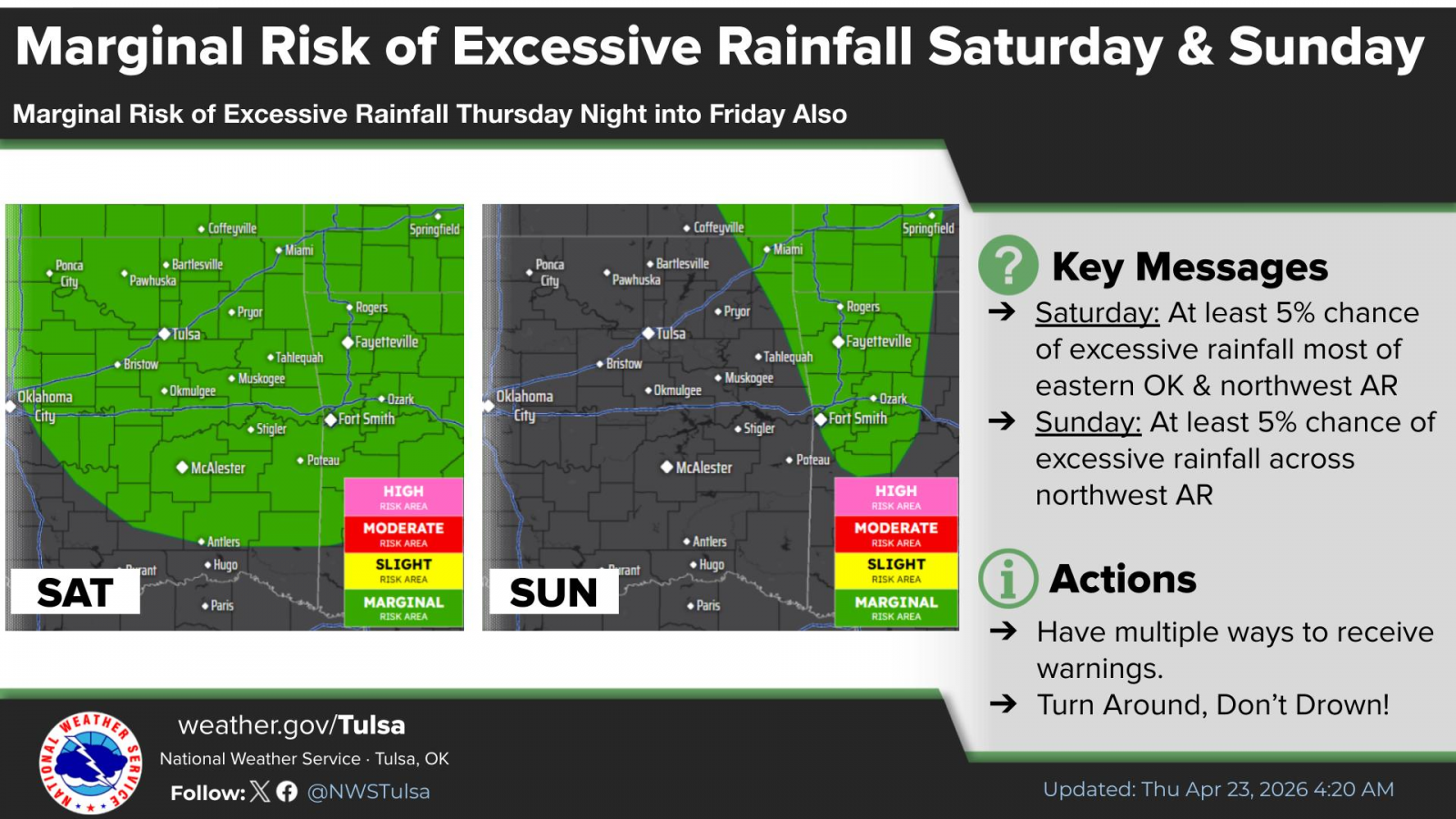
Severe weather remains in the area for Sunday before the system moves to the east for Monday. Excessive rainfall could cause some localized flooding concerns.
« Back to News